GIS for SRA Mumbai


URL : http://umd.nic.in/sra
Andriod App : AASARA (Andriod)
Apple App : AASARA (Apple)
01/01/2020 : Total hits for GIS data 1.05 Crore, Total downloads of Mobile : 10,000+
15/12/2018 : Soft launch of iOS app AASRA for Apple device users.
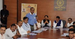
12/9/2018 : Inauguration of AASRA mobile app by Hon’ble CM of Maharashtra for Android users.
21/11/2017 : GIS based application for SRA : Inauguration of website by Hon. CM of Maharashtra http://umd.nic.in/sra
2016-2020 : GIS Portal is a part of these initiatives where GIS data for slums spread over entire Mumbai Municipal Corporation area has been created, which can be useful for citizens and other relevant stakeholders of Slum Rehabilitation Schemes. This encompasses more than ten layers containing administrative ward boundaries, village boundaries, Slum Cluster boundaries, SR Schemes boundaries etc., including terrain map services.
Further to provide citizen centric information of slum rehabilitation (SR) schemes on mobile, based on user-location where GIS data for slums spread over entire Mumbai Municipal Corporation area has been created.This GIS Mobile App is developed with the technical support of Utility Mapping Division of NIC,New Delhi.


